
In 1706 the 5th Earl of Kingston applied for permission to make a “ride” through Bilhaugh Wood. Permission was necessary because, although the 4th Earl had gained the right to create a Park by enclosure from Sherwood Forest, the 5th Earl’s plans travelled beyond that boundary. His proposed route would facilitate a quicker journey direct from the original Thoresby Hall (1683), to Ollerton town in readiness for Newark beyond. Permission was granted.
Clearly still visible on Google maps, though long since abandoned and off limits today, the “ride” led in a straight line from the original Thoresby Hall by the east of the lake, over the original site of Green Bridge, through Ice House Wood and the Pleasure Gardens, alongside the site where one day would stand the Woodyard, and continue for about one mile before stopping at the lodge which became Buck Gates. This part of the journey so far, would be named Chestnut Avenue.
Chestnut Avenue suffered like every other landscaped area of Thoresby as trends in forestry changed. However, there is a story that the Estate Manager Mr Holder was dismissed in the early 1950's when Lady Manvers discovered he had started felling trees there. Holder was replaced by Mr Tapper, whose foresight started a vigorous planting scheme in Thoresby. Apparently Chestnut Avenue was restored in 2000 by clearing it of the silver birches which had taken root along its length over the decades. Indeed, one can see the clearing where the original Duke's carriages would have passed on the video posted on this blog of Thoresby’s 2015 Hayride.
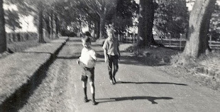
Above: The Craig brothers walking along a well-kept Chestnut Avenue c.1958, heading for the toys shops in Ollerton.

Above: 1964. The view from atop one of the avenue's Chestnut Trees, looking towards the woods which concealed Proteus Camp and the A614 beyond.

Above: Green Drive. This postcard places it near to Buck Gates. At the end of Chestnut Avenue there were indeed several such woodland paths converging there.
b.jpg)

Above: 1985 and c 2013. The road which had linked Perlethorpe with The Woodyard, leading then to Edwinstowe beyond, had several bends. In this way it avoided higher grounds, and also retained a link to Green Bridge and what was once the second Hall on the other side. All traces of the road are now gone, and the fields extended.


Above: Scotch Firs, Thoresby Park postcard c.1900. Colour photograph 2014.
This relatively undisturbed region of Thoresby, close to the rear of Rose Cottage and the A614, became open to the public during their "Permitted Walks" scheme. Access might be more limited today.
No comments:
Post a Comment
Thoresby Park History blog is suitable for all ages.